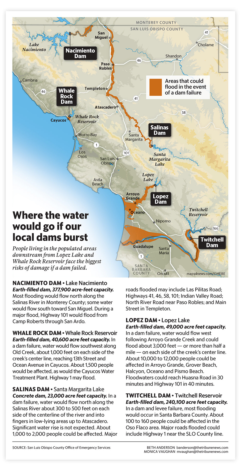
Flooding potential near local dams
Mapping • Design • Research • Editing
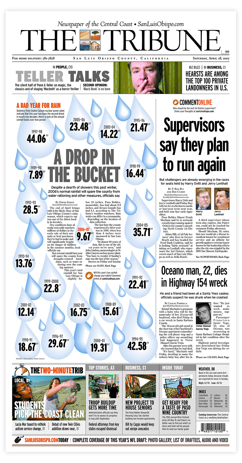
SLO County's rainfall history
Design • Illustration
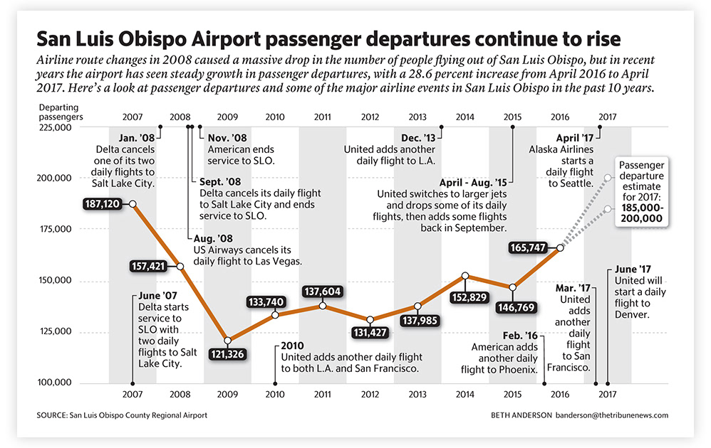
Passengers and flight history at the SLO County airport
Research • Data • Design • Editing
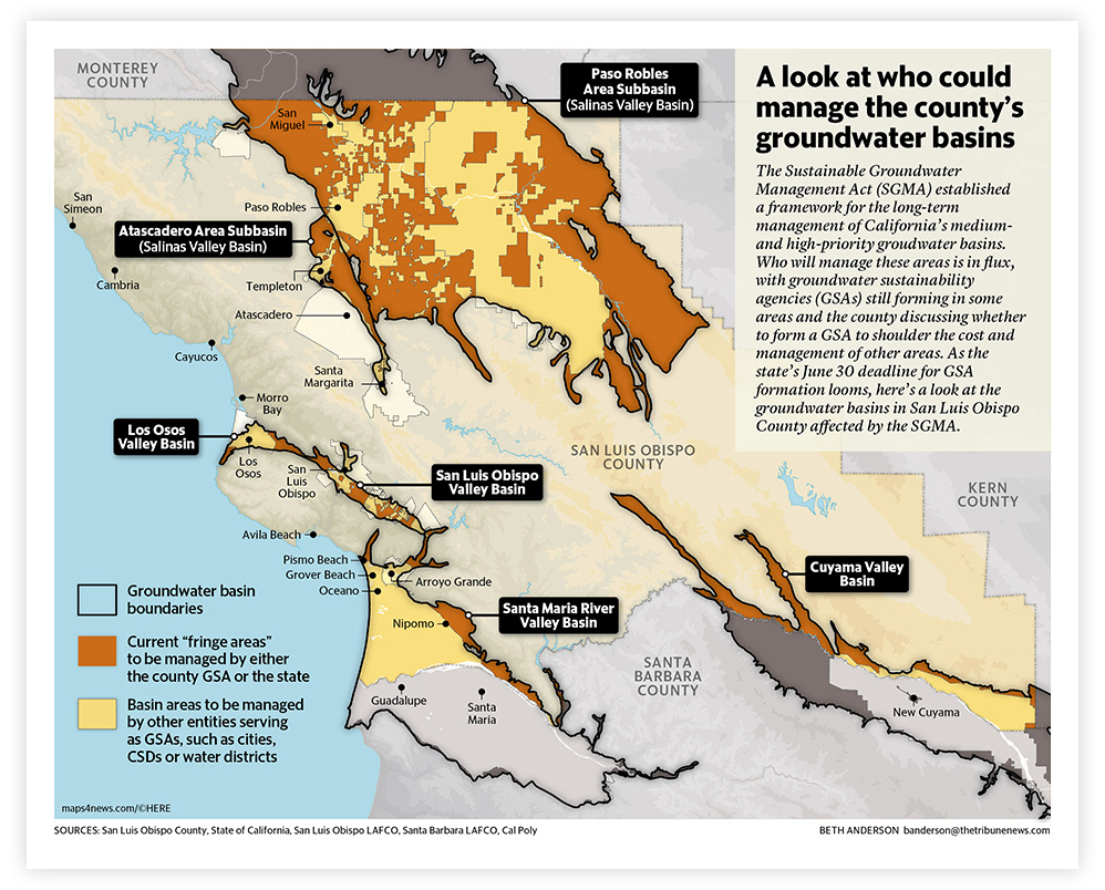
groundwater basin management areas
Research • Mapping • Design • Writing
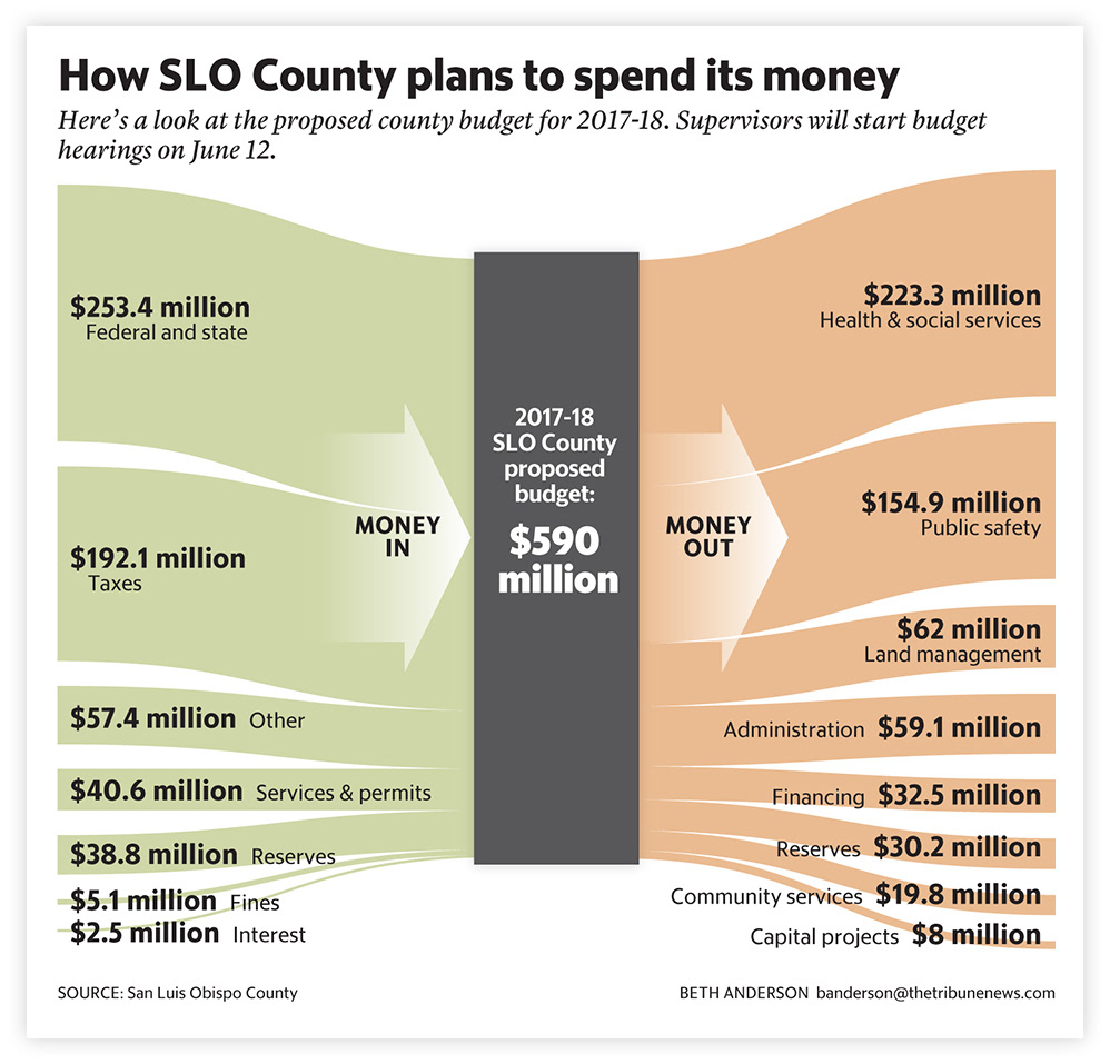
Money in, money out: A look at SLO County's budget
Design • Illustration
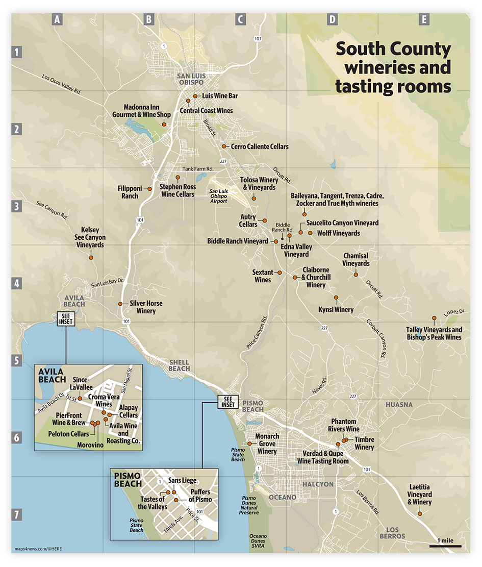
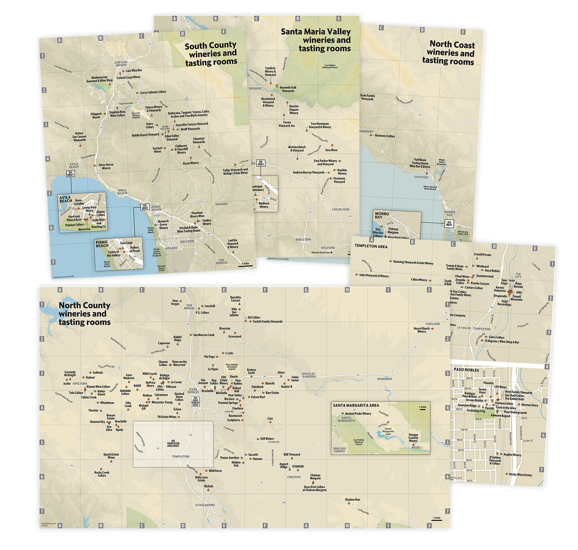
Winery maps for Vintages magazine
Research • Mapping • Design
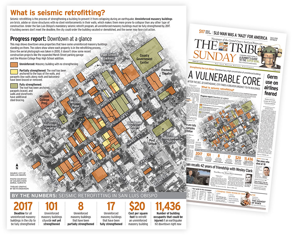
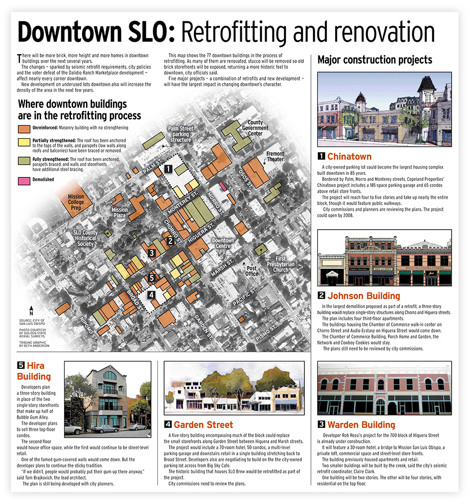
quake-proofing Downtown San Luis Obispo's structures
Research • Mapping • Design • Writing
Quake-proofing downtown San Luis Obispo
Design • Mapping • Editing
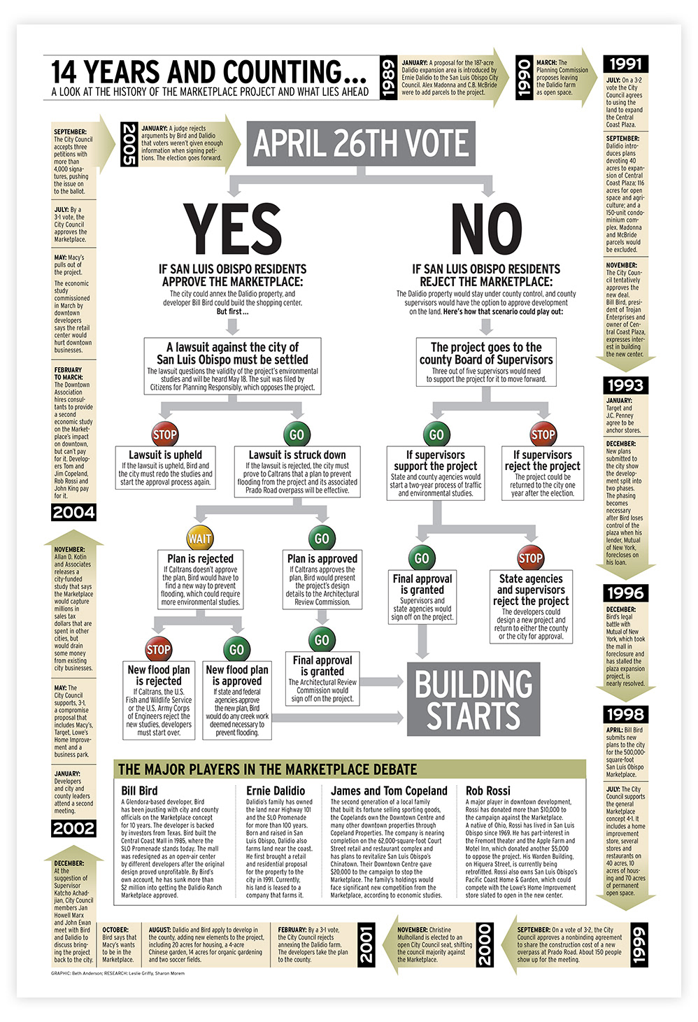
The Marketplace project's past and future
Research • Design • Writing • Editing
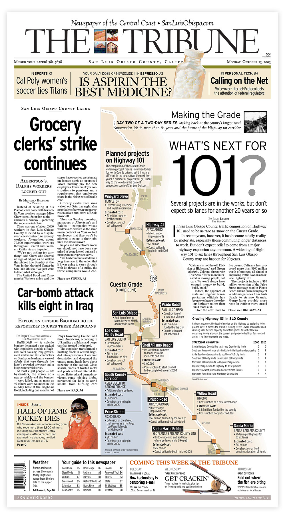
Highway 101 projects
Design • Mapping • Writing • Editing
explanation of SLO County's emergency plan
Design • Writing • Editing
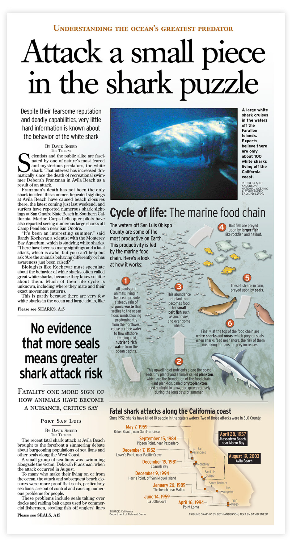
Shark attacks explained
Design • Illustration • Mapping • Writing • Editing
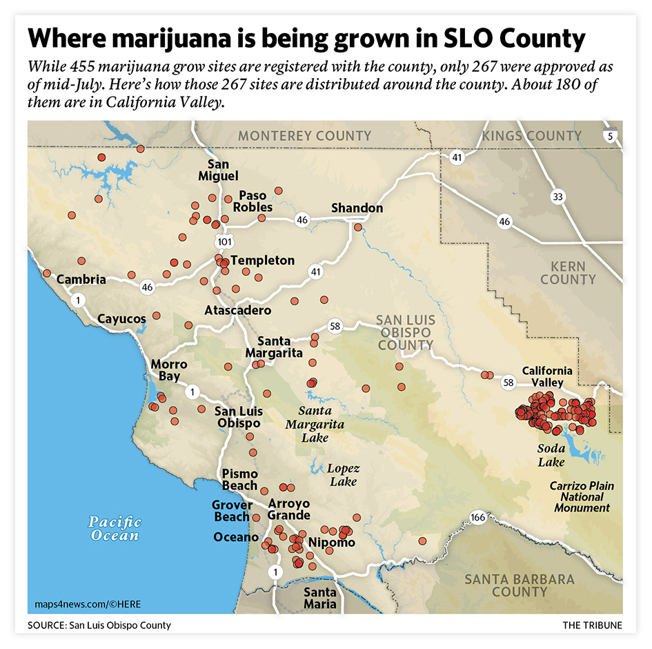
County marijuana grows
Design • Mapping • Data
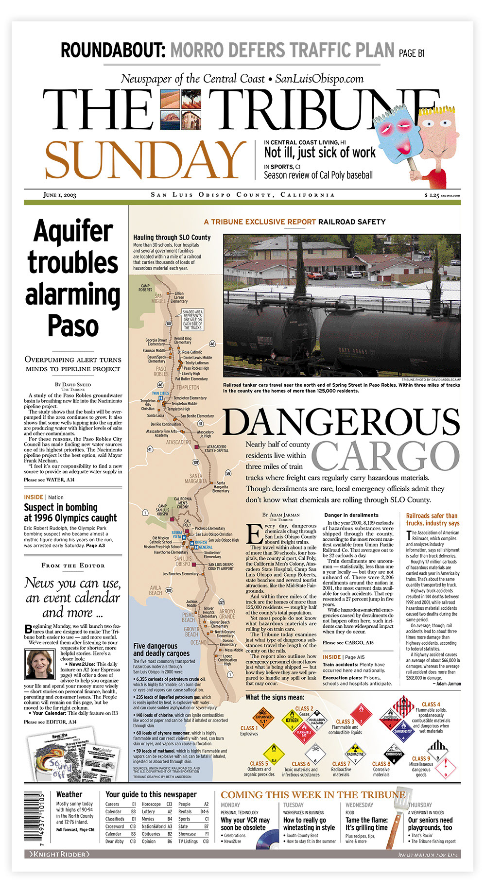
Hazardous materials on local rail lines
Design • Mapping • Research • Writing • Editing
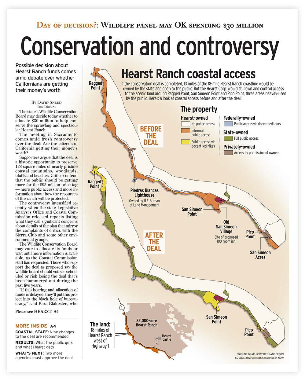
coastal access after the hearst ranch deal
Design • Mapping • Writing
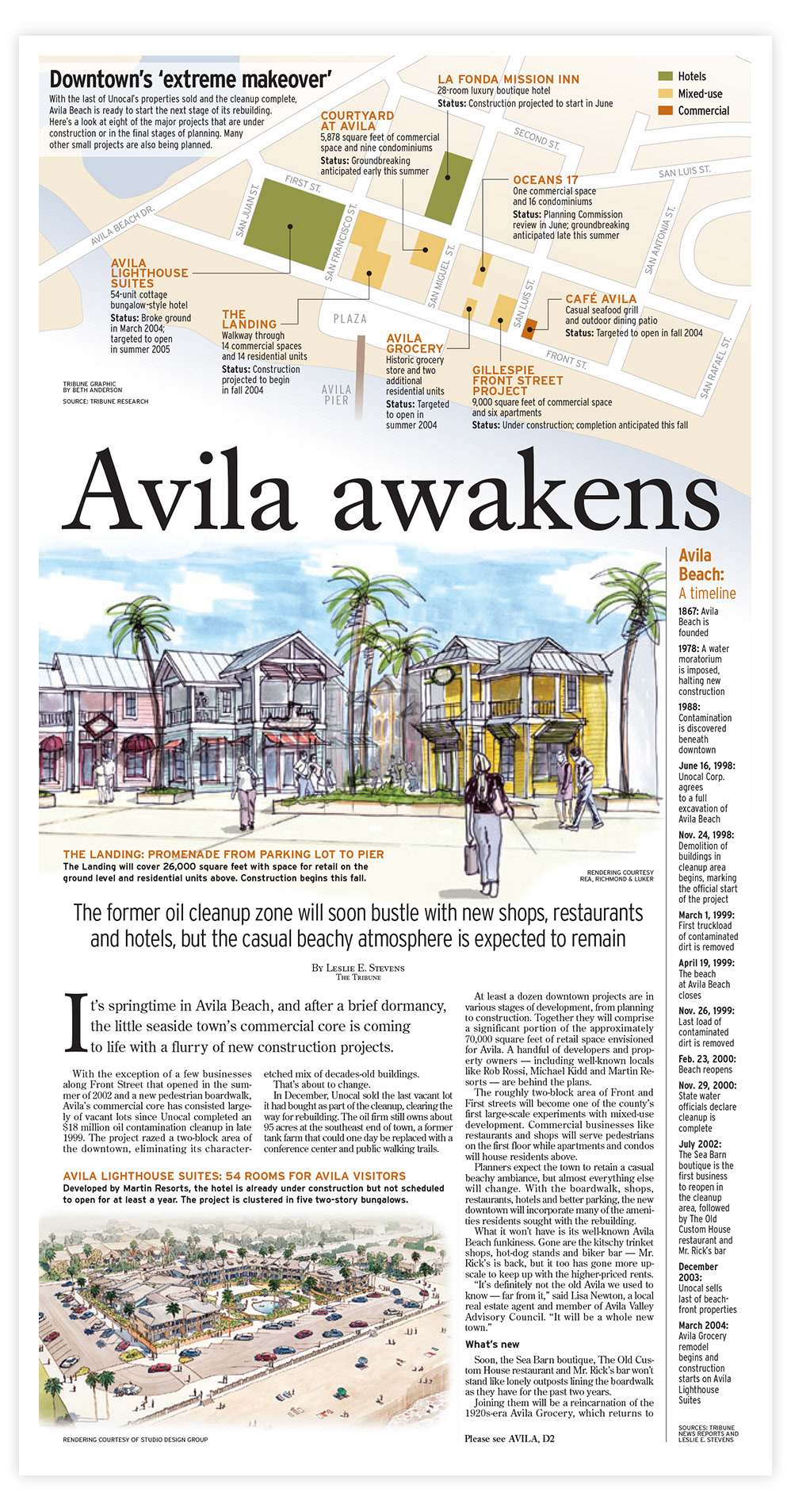
Avila Beach after the oil spill cleanup
Mapping • Page design • Writing • Editing
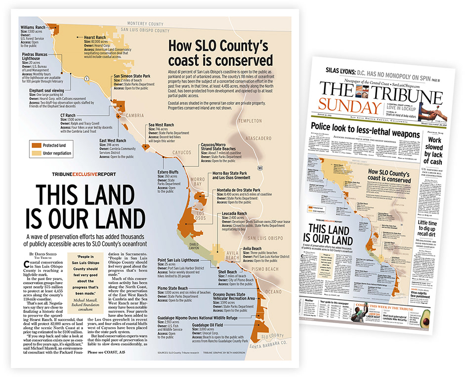
Conserving SLO County's coastline
Mapping • Design • Writing • Editing
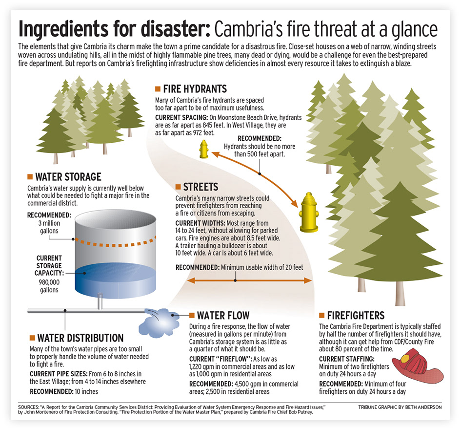
How a major fire could affect Cambria
Design • Illustration • Writing • Editing
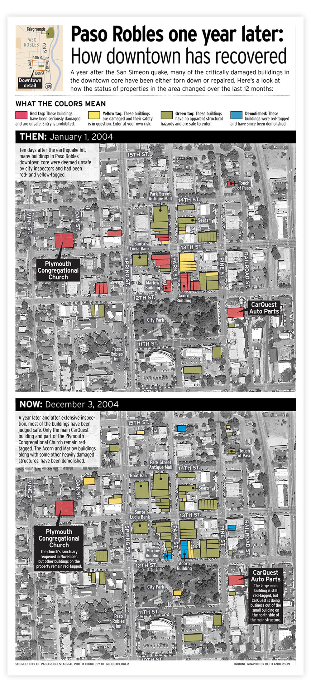
Paso Robles a year after the San Simeon earthquake
Design • Mapping • Research • Writing
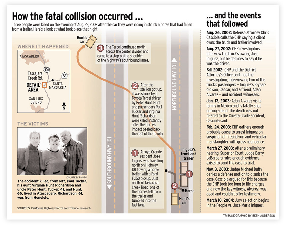
Anatomy of a fatal collision on the Cuesta Grade
Design • Mapping • Writing • Editing
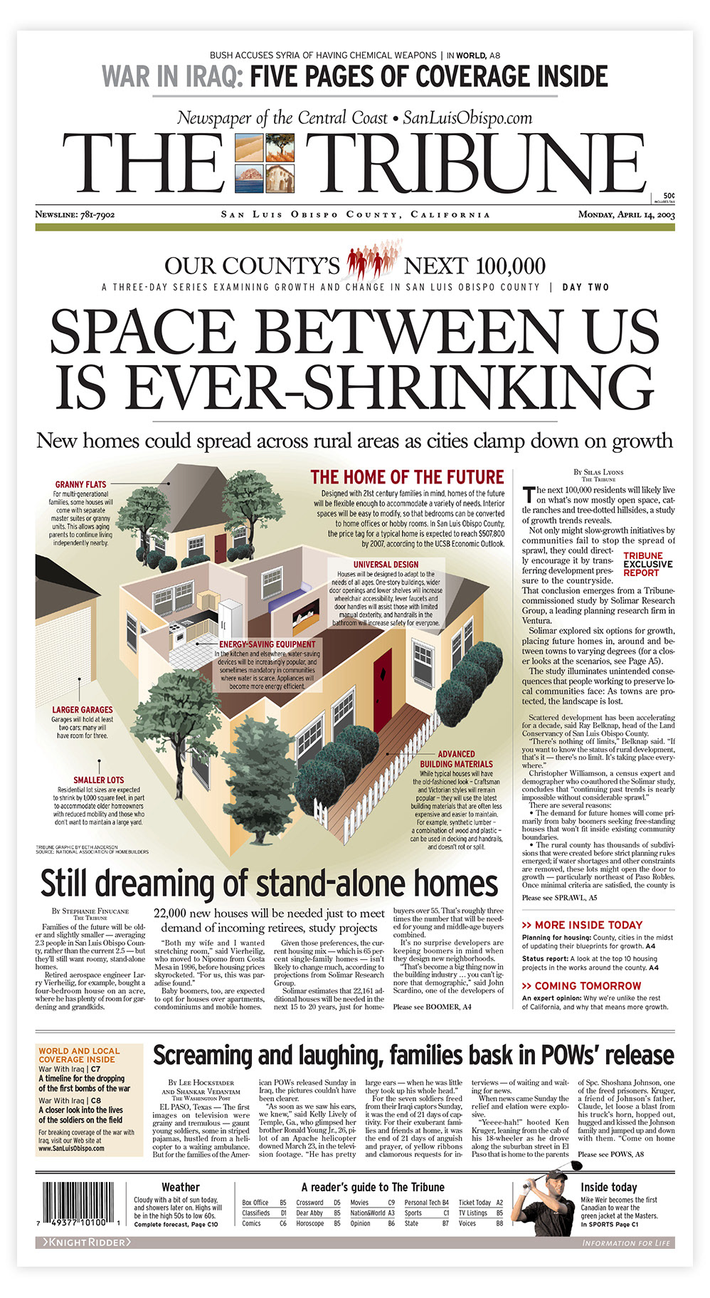
The home of the future
Illustration • Page design • Research • Writing • Editing
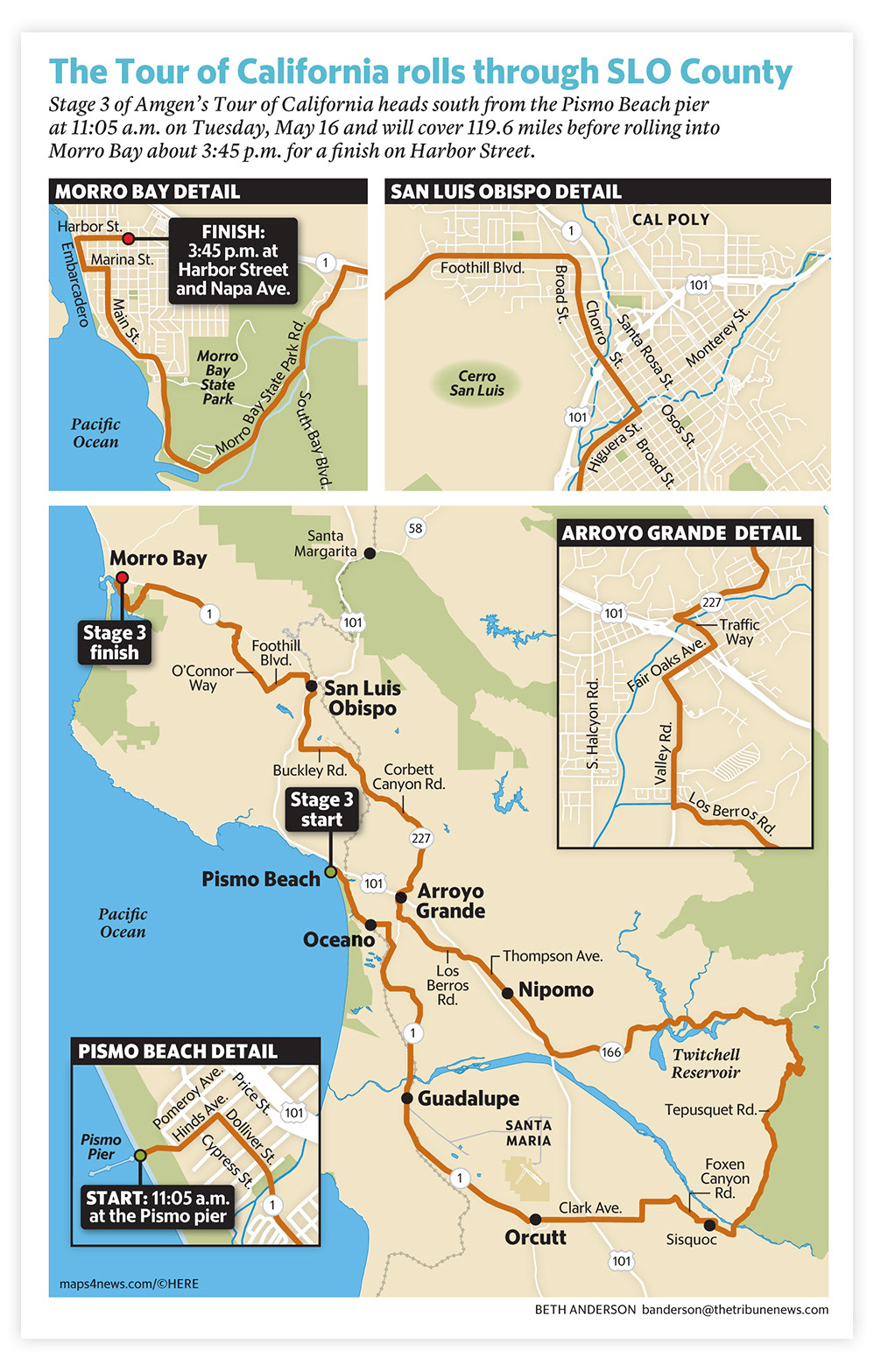
The Tour of California route through SLO County
Mapping • Design
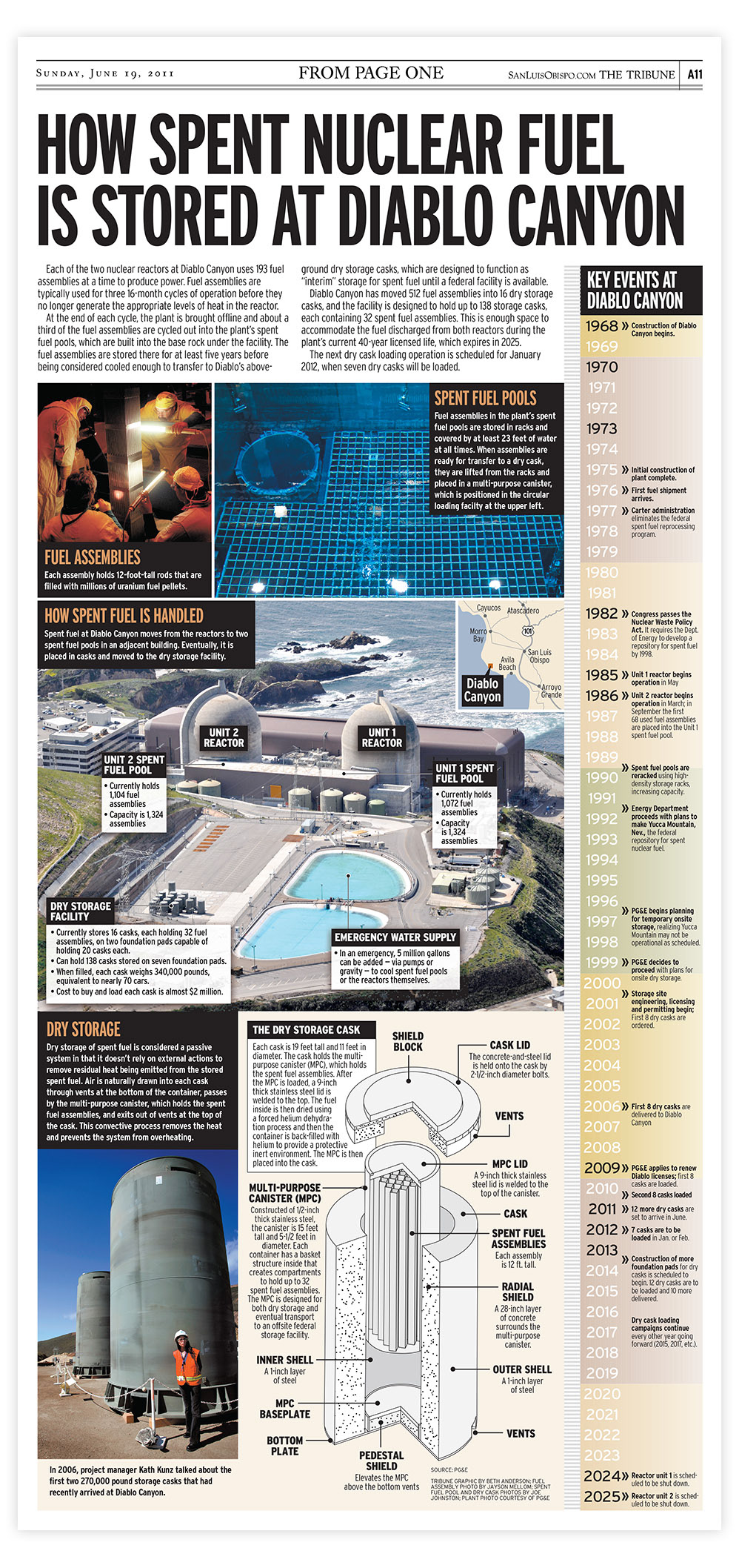
How Diablo Canyon stores its nuclear waste
Research • Page design • Illustration • Writing • Editing
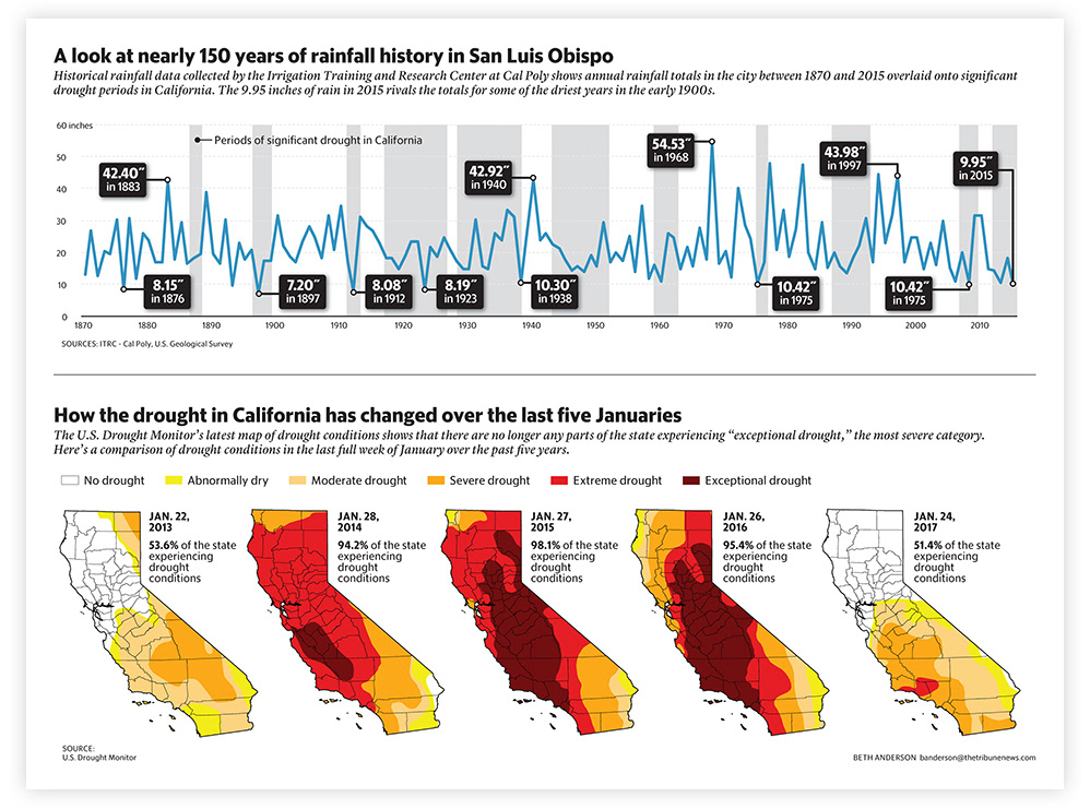
SLO County's historical rainfall and drought periods
Design • Research • Data
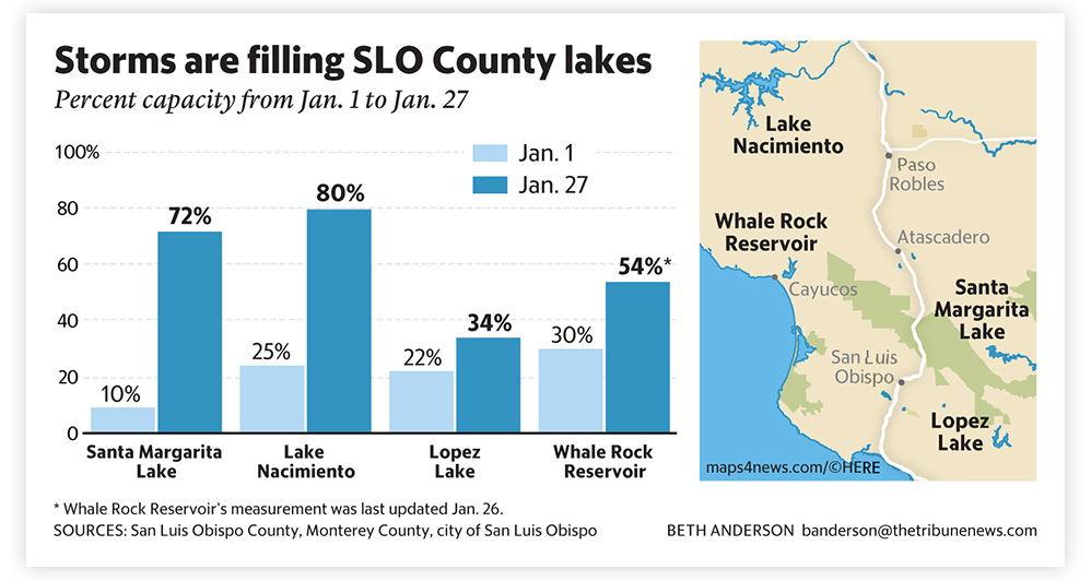
slo County gets Rain after a long drought
Design • Data • Mapping
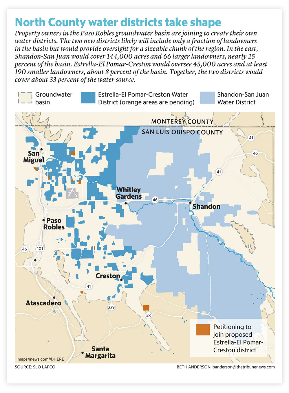
emerging Groundwater basin management groups
Mapping • Design
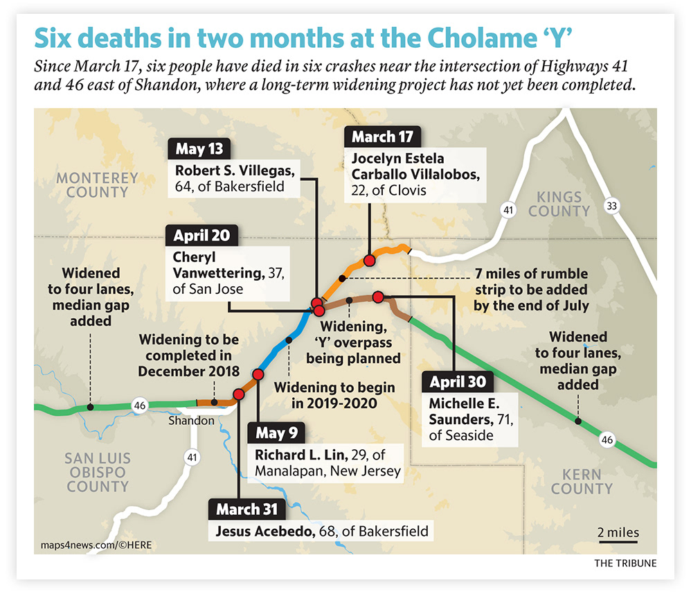
a dangerous stretch of road
Mapping • Research • Data • Writing
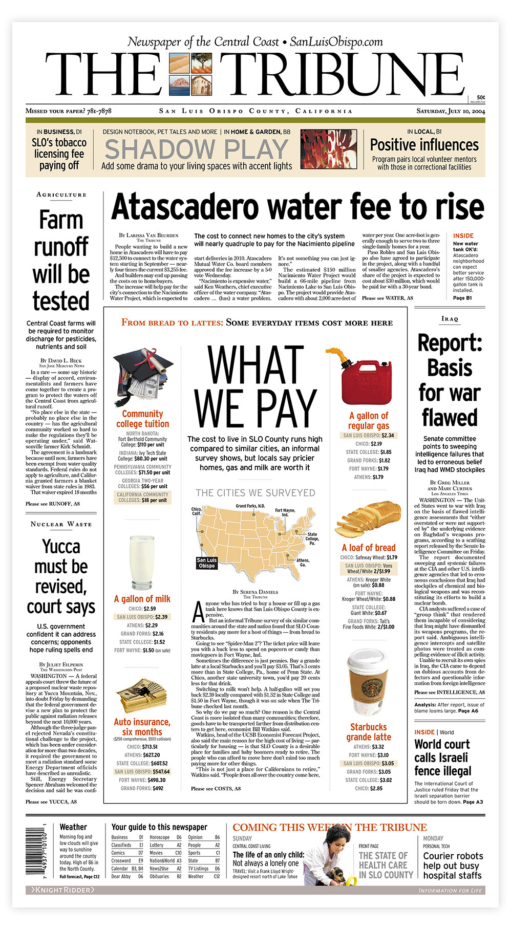
How prices in SLO County compare to elsewhere
Design • Mapping
